 |  |

![]() You are here: Home / Explore SA Memory /
Timeline /
Timeline images
You are here: Home / Explore SA Memory /
Timeline /
Timeline images
Timeline images
Display Thesaurus-Associated Content
Listing for term 'maps'
 |
The maritime portion of South Australia |
|
|
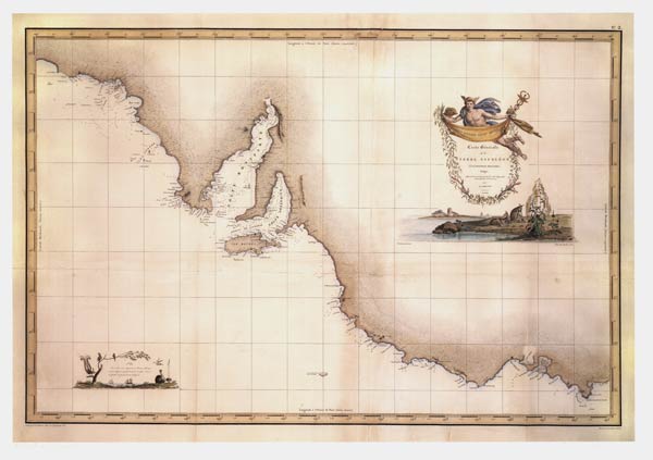 |
Carte generale de la Terre Napoleon [map] |
|
|
 |
Kingston Map |
|
|
 |
Satellite images of earth from space: Australia ce |
|
|
 |
Map of northern runs |
|
|
 |
South Australia at the time of settlement |
|
|
 |
Around the Commonwealth by aeroplane [game] |
|
|
 |
Terra Australis nondum cognita |
|
|
 |
Pacific Ocean |
|
|
 |
Flinders explains his geographical findings |
|
|
 |
The Crystal Palace game: a voyage around the world |
|
|
 |
Part of South Australia |
|
|
 |
Northern Territory annexed by South Australia |
|
|
 |
Sandringham Station misplaced on the maps |
|
|
 |
Chart of the Murray River, between Funnel Bend and |
|
|
|
The maritime portion of South Australia |
|
|
 |
Letter written to George Jones |
|
|
|
The maritime portion of South Australia |
|
|
|
Terra Australis nondum cognita |
|
|
|
Pacific Ocean |
|
|
 |
Letter written to George Jones |
|
|
|
Part of South Australia [cartographic material] |
|
|
 |
Chart of Cape Jervis |
|
|
|
Part of Southern Australia from 132 to 141 degrees |
|
|
|
Kingston Map |
|
|
 |
Map of Graham Land 1928 |
|
|
 |
Chart of Port Adelaide, South Australia |
|
|
 |
Map shewing the special surveys in South Australia |
|
|
 |
Rough plan and sketch of the township of Kooringa |
|
|
 |
British parliamentary papers, Colonies: Australia |
|
|
 |
South Australia shewing the division into counties |
|
|
 |
Map of Light's Plan of the city of Adelaide in Sou |
|
|
 |
Map of the settled portion of S. Australia 1850 [c |
|
|
 |
A sketch of Encounter Bay, South Australia |
|
|
 |
The district of Adelaide, South Australia : as div |
|
|
 |
[Plan of townships of Currency Creek and Goolwa] [ |
|
|
 |
Plan of the Mount Barker special survey |
|
|
 |
Tracing of lands on banks of Lake Alexandrina [Sou |
|
|
 |
Sketch of South Australian Company's run west of M |
|
|
 |
Plan and description of the South Australian Compa |
|
|
 |
Plan of the South Australian Company's Runs at Lak |
|
|
 |
Plan shewing the position of the South Australian |
|
|
 |
Plan of the County of Russell [South Australia Com |
|
|
 |
Plan shewing the Property of the South Australian |
|
|
 |
Map of south eastern South Australia from Coorong |
|
|
 |
Map shewing the line of the intended Adelaide City |
|
|
 |
Plan of the intended new port, Adelaide, South Aus |
|
|
 |
Plan of sections A - K, Port Adelaide [South Austr |
|
|
 |
Plan of McLaren Wharf [South Australian Company ma |
|
|
 |
Tracing of land sold to Edward Bayley [South Austr |
|
|
 |
Western Sources of the Torrens [South Australia Co |
|
|
 |
Tracing of a portion of the survey at the sources |
|
|
 |
Map showing land purchases near Kingscote, Kangaro |
|
|
 |
Map showing land purchased in survey of Western So |
|
|
 |
Plan of Eastern Sources of the Torrens [South Aust |
|
|
 |
Tracing of Sections lately purchased in the Wester |
|
|
 |
Map of sections at Jupiter Creek |
|
|
 |
Plan of Encounter Bay and Currency Creek [South Au |
|
|
 |
Tracing of sections in the Hundred of Onkaparinga |
|
|
 |
Tracing of sections purchased near Government Farm |
|
|
 |
Plan of Blocks D and E, section 3, at Kingscote, K |
|
|
 |
Plan of Section No.1, at Kingscote, Kangaroo Islan |
|
|
 |
Tracing of portion of the Torrens Special Survey [ |
|
|
 |
Map of sections purchased in the Hundred of Gilber |
|
|
 |
[Map of sections purchased in the Hundred of Breme |
|
|
 |
Unidentified map showing land sections purchased [ |
|
|
 |
Tracing of Sections near Lake Victoria and the Riv |
|
|
 |
Tracing of sections, Hundred of Moorooroo [South A |
|
|
 |
Tracing of section purchased in the Hundred of Gil |
|
|
 |
Plan of allotments at Port Adelaide, Section A [So |
|
|
 |
Tracing of sections in the Hundred of Upper Wakefi |
|
|
 |
Tracing of sections in the Hundreds of Julia Creek |
|
|
 |
Tracing of sections in the Hundreds of Saddleworth |
|
|
 |
Tracing of sections in the Hundreds of Nuriootpa, |
|
|
 |
Tracing of sections within the Hundred of Barossa |
|
|
 |
Tracing of 'South Adelaide', Port Adelaide Railway |
|
|
 |
Tracing showing special survey eastward of Mount L |
|
|
 |
Tracing showing sections in the Hundreds of Kanman |
|
|
 |
Tracing showing sections north of Lake Alexandrina |
|
|
 |
Tracing showing sections in the Hundred of Kanmant |
|
|
 |
Tracing showing sections in Encounter Bay and Gool |
|
|
 |
Tracing showing sections in Hundred of Yankalilla |
|
|
 |
Tracing showing sections in Hundreds of Yatala, Pa |
|
|
 |
Tracing showing sections in Hundred of Onkaparinga |
|
|
 |
Tracing showing sections in Hundred of Encounter B |
|
|
 |
Tracing showing sections on eastern boundary of Mo |
|
|
 |
Tracing showing sections in Hundreds of Talunga, S |
|
|
 |
Tracing showing sections in Hundreds of Adelaide, |
|
|
 |
Tracing showing sections in Hundreds of Gawler, Gi |
|
|
 |
Tracing showing sections in Hundred of Port Adelai |
|
|
 |
Tracing showing sections in Hundreds of Barossa, P |
|
|
 |
Plan of the County of Light [South Australia Compa |
|
|
 |
Tracing showing sections in Hundreds of Moorooroo, |
|
|
 |
Tracing showing sections in Hundreds of Yankalilla |
|
|
 |
Tracing showing sections in Hundreds of Kooringa a |
|
|
 |
Tracing showing sections in Hundreds of Port Gawle |
|
|
 |
Tracing showing sections in Hundreds of Kanmantoo |
|
|
 |
Tracing showing sections in the Hundreds of Mobilo |
|
|
 |
Map showing sections in County of Russell, Hundred |
|
|
 |
Plan of the County of Stanley and part of the Coun |
|
|
 |
Sketch of the country north of Mount Remarkable [S |
|
|
 |
Map of South Australia including the recent discov |
|
|
 |
Fitzroy Gold Fields, Port Curtis showing the route |
|
|
 |
Map of Fleurieu Peninsula showing Hundreds of Enco |
|
|
 |
Plan of the settled districts of South Australia |
|
|
 |
Flinders' chart upon an enlarged scale [cartograph |
|
|
 |
Port Augusta from the air 1945 |
|
|
 |
Port Augusta from the air 1942 |
|
|
 |
Port Augusta : the railway, shipping and distribu |
|
|
 |
Plan shewing the Adelaide and Port Darwin telegrap |
|
|
 |
South Australia. Chart of the approach to Port Aug |
|
|
 |
South Australian railways [map] |
|
|
 |
Map shewing lines of railways in South Australia |
|
|
|
Robinson's map of South Australia, ... |
|
|
 |
Frearson's plan of Port Augusta |
|
|
 |
The continent revealed |
|
|
 |
South Australia, Spencer's Gulf. Port Augusta |
|
|
 |
Plan of the town of Port Augusta and suburban land |
|
|
 |
Trans-continental railway from Kalgoorlie, ... |
|
|
|
Plan shewing the Adelaide and Port Darwin telegrap |
|
|
 |
Map of a portion of South Australia, north-west of |
|
|
 |
Map of part of the Special Survey of the Western S |
|
|
 |
Map showing section purchased at Mount Gambier [So |
|
|
 |
Part of South Australia shewing the recent discove |
|
|
 |
Plan of Extended Township of Willunga [South Austr |
|
|
 |
Plan of Noarlunga [South Australia Company map] |
|
|
 |
Plan of proposed new dock, Port Adelaide [South Au |
|
|
 |
Plan of sections in the Hundred of Nuriootpa [Sout |
|
|
 |
Portion of plan of Eastern Sources of the Torrens |
|
|
|
Sketch of South Australian Company's run west of M |
|
|
 |
Tracing of section 5274 on the S.S. of the Sources |
|
|
 |
Tracing of sections at Waitpinga and Encounter Bay |
|
|
 |
Tracing of sections in the Hundred of Nuriootpa [S |
|
|
 |
Tracing of Sections purchased south east of Mount |
|
|
 |
Tracing of section 1707 Lyndock Valley [South Aust |
|
|
 |
Tracing of sections lately purchased on the Gilber |
|
|
 |
Plan of the County of Hindmarsh compiled from the |
|
|
|
Around Australia |
|
|
 |
01. Groote Eylandt [map] |
|
|
 |
17. Ritchie's Ridge |
|
|
 |
County Fergusson |
|
|
 |
County Daly |
|
|
 |
South Australia with Yorke Peninsula part surveyed |
|
|
 |
Point Turton on Hardwicke Bay |
|
|
 |
Innes National Park |
|
|
 |
Yorke Peninsula mineral claims |
|
|
 |
Approach to Point Turton jetty |
|
|
 |
W W Hughes pastoral lease at Wallaroo |
|
|
 |
Chart of the anchorages in Encounter Bay [cartogra |
|
|
 |
Map, Language groupings in South Australia |
|
|
 |
Plan of Murray Lands railways [map] |
|
|
 |
Proposed Paringa to Barmera railway |
|
|
 |
Barker's expedition |
|
|
 |
Becelaere : secret, army barrage map (second phase |
|
|
 |
Region around Polygon Wood and Zonnebeke, West Fla |
|
|
 |
Ligny-Thilloy : trenches corrected to 11-11-16 |
|
|
 |
Map of Gallipoli |
|
|
 |
Maps of Gallipoli Peninsula |
|
|
Search Again
Copyright and this website | Contact us | Accessibility | Disclaimer | Privacy | Research enquiries | FOI | ||